Corinth Floodplain Information
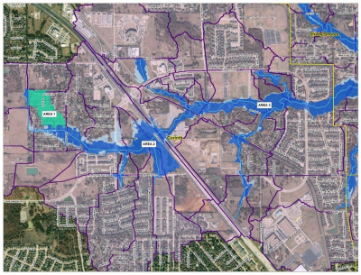
To determine if your property is likely within or near the Special Flood Hazard Area (SFHA), also known as the area inundated by the 1% annual chance Base Flood, use the City’s Interactive Geographic Information System Map. The maps are the result of updated studies of the floodplain conducted by Federal Emergency Management Agency (FEMA).
For directions on how to view the SFHA, visit the GIS Floodplain Instructions page.
FEMA FAQ and Information
- Flood insurance Information
- FEMA digital maps (Search for your address, expand "Search All Products")
- Map Service Center (For Interactive map select “Go To NFHL Viewer”)
- Why you need Flood Insurance pamphlet
- How Can I Pay Less For Flood Insurance?
- For those properties that are being added to the floodplain (zone x to zone A, AE, AO) please investigate grandfathering rules for obtaining flood insurance. Insurance obtained before maps become effective will allow for a graduated step plan for these properties that are added to the floodplain. To find out specifics for your property you will need to contact a flood insurance specialist through your homeowners insurance.
- Grandfathering. An exemption based on circumstances previously existing. Under National Flood Insurance Program (NFIP) statutory grandfathering, buildings located in Emergency Program communities and Pre-FIRM buildings in the Regular Program are eligible for subsidized flood insurance rates. Under NFIP administrative grandfathering, Post-FIRM buildings in the Regular Program built in compliance with the floodplain management regulations in effect at the start of construction will continue to have favorable rate treatment even though higher Base Flood Elevations (BFEs) or more restrictive, greater risk zone designations result from FIRM revisions. Policy holders who have remained loyal customers of the NFIP by maintaining continuous coverage (since coverage was first obtained on the building) are also eligible for administrative grandfathering.
The City of Corinth’s current Flood Insurance Rate Map (FIRM) became effective June 19, 2020 as issued by FEMA. The current FIRM with Letters of Map Revisions (LOMRs) can be viewed in the following ways:
- SFHA and Base Flood Elevation determinations based on the FIRM and LOMRs may be obtained by calling the City Engineer in the City of Corinth Engineering Department at (940) 498-3265. Also, building elevation certificates for your property may be available from the City. If your home is within a SFHA an elevation certificate may be able to prove that your finished floor is higher than the floodplain and thus reducing your flood insurance costs.
- FEMA digital maps (Search for your address, expand "Search All Products")
The City of Corinth hereby informs all inquirers of the mandatory flood insurance purchase requirement for all federally backed mortgages with structures located in the SFHA/Floodplain. Please note that a property not in the SFHA as shown on the FIRM may be still at risk of flooding from a local drainage situation not shown on the FIRM and/or from a flood greater than those events as shown on the FIRM. Therefore, the determination assistance provided by the City does not create liability on the part of the City or any officer or employee of the City for issues that result from reliance on the FIRM information.
For additional Information regarding flood insurance contact the following:
Gilbert L. Giron, CFM
Regional Flood Insurance Liaison
Gilbert.giron@fema.dhs.gov
(940) 383-7253

